www.cuesinc.com | salesinfo@cuesinc.com
CUES Product Catalog
CUES Product Catalog
72
73
CUES
Use AMP for precise location of your underground
pipeline assets for proactive sewer repair and
replacement.
Identify the critical problems, such as inclination,
sags, bends, etc. in your wastewater system.
The CUES AMP data can be used with your
centralized system of record keeping and be
accessible to all decision makers to assure proper
defensible spending.
Identify short and long term concerns to be
considered in future CIP and O&M budgets.
Integration of exact positional location with
CCTV-identified anomalies and CUES asset-
based GraniteNet decision support software
allowing for accurate and cost-effective spot repairs.
Use data for as-built drawings and confirm that
installations meet location specifications.
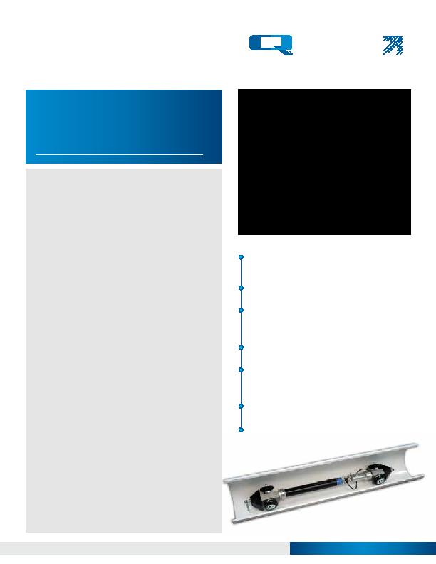
Project specific custom carriers available
upon request.
CUES AMP is the world's most versatile and
unique autonomous multi-purpose pipeline
mapping system that delivers exact 3D
positional data.
AMPVUE, a cloud based free service for all users of
CUES AMP is available to manage all the data produced
by the CUES AMP. This tool provides industry standard
enterprise GIS outputs, multiple CAD formats and
standard detailed reports.
·
Provided as a free service to all users of the CUES
AMP.
·
AMP data is immediately converted and available for
download in industry-standard GIS & CAD formats.
·
Cloud technology, accessible via a web browser.
·
Manages all data produced by the CUES AMP.
·
Permits non-technical users to easily access data.
·
Standard reporting modules, allowing easy
documentation of projects performed with the CUES
AMP.
·
Easy data integration (import/export) with any existing
enterprise GIS.
AMPVUE Professional is available for any size operation
requiring a GIS (Geographic Information System).
AMPVUE Professional provides a cost effective web-
based GIS platform at a competitive cost and includes
all of the functionality in AMPVUE, plus:
·
All-in-one information repository, includes modules for
Document and Photo Libraries.
·
Easy to use web-based GIS display (can integrate data
from any other location/mapping technology).
·
Allows for seamless integration of legacy information
(e.g. old CAD maps).
·
Allows for creation/use of custom, industry-specific
queries and reports.
·
Municipalities without a GIS can be up and running
with minimal cost.
·
Automated bend radius analysis modules utilizing CUES
AMP results.
·
Custom reporting modules can be created for various
industry-specific Key Performance Indicators (KPI).